
Lisa Wanncheck and I
3/23/18 14.5 miles 7 waterfalls, 7 hours
Lisa and I got a late start because she works night shift and got home at 6 am. We left at 9:30 am. We arrived in Brevard about 11:30. The first waterfall we are going to is Grogan Falls near John’s Rock. I knew right where to go because I’d just hiked it. This falls is off Cat Gap Trail. We park near the trailhead and start to hike up the trail which go steadily upward without any switchbacks. It has a 784 ft elevation gain in the first 2 ish miles.
We hike past the turn to Johns rock and keep going around the loop. We get to the next intersection where you can turn to go to Johns rock also. There are some people there we get some directions to the falls. I couldn’t find it last time. So we keep going around the 4 mile loop till we get to Butter Gap Trail. Thankfully this side of the trail is downhill!
We came to an unmarked trail and couldn’t decide weather to turn it not. A lady and her kids come by and say that trail goes back to where we just were so we continued down the trail to Butter Gap Trail.
We cross a creek and turn left on Butter Gap. We continue about a mile and a half and we see an intersection trail called Long Branch trail which is not on any of our maps! A couple of mountain bikers come by and tell us to go left about a mile. Thank goodness!
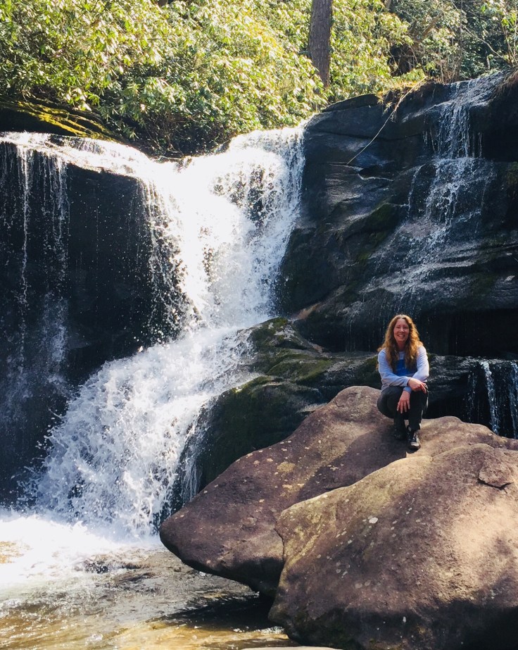
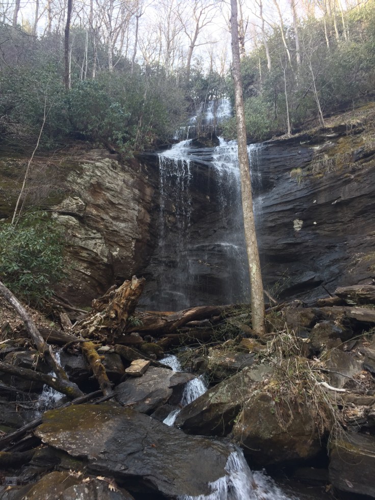
We travel down till we can hear this falls. There is a Steep sort of trail to the base. It’s a tough one! But at the bottom! Grogan Falls is awesome! This falls looks like one that someone would design. It Is beautiful.
We took a ton of pictures here then went to find the next one! Going back up from the bottom of the falls is a steep muddy mess! It was like climbing a ladder of tree roots.

We hiked back to the area where the trails intersected and went back down the trail towards the parking lot. The map shows the next falls near there.
We continue down Cat Gap Trail until we can hear the falls. A guy we met said there was an unmarked trail to the right. We find it and follow it down and alongside the creek to Cedar Creek Falls. We figure most people miss this because there is no sign and it only sort of looks like a trail! This falls is pretty but not tall. Lisa doesn’t hesitate to rock hop to a great place to take pictures. There was a jumpable gap between a couple rocks that I just wouldn’t jump.

She said it’s not that far but……
So she gave up and didn’t bug me!! The man we met said there was an upper and lower falls but we only found this one.
We head back to the trail and hear voices. A couple of people have walked by. We figure they didn’t even know the Falls was down there because there is nothing marking this trail. Without her Waterfalls of NC book we wouldn’t know either.
The parking lot is about a half a mile. That’s when I figure out that if we would of taken the correct trail it would of been about a 2 mile in and out walk instead of a 4 mile loop walk and it would of had very little elevation.
We jump in the car and head back down to the next waterfall.
The book says the trailhead is just before the bridge. I know where the bridge is (so I think). We go back and forth around the bridge and can’t find it. Then I finally re read it and realize it’s up above Looking Glass Falls. We head that way, pass the falls and up on the right is a pile of cars. This is it. This is Moore’s Cove Falls and it’s only a mile off the road so of course, lots of people. Its getting late and we have more waterfalls to see so we book down the trail. I do mean book! We practically run to the falls. This is one of those falls you can go under or behind.


We have more waterfalls to find so off we go practically running back to the car.
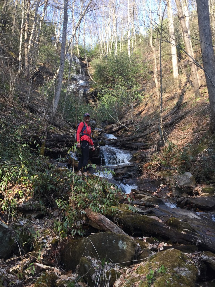
The next waterfall on the list is Avery Creek Falls and Twin Falls. This one is down the road that the stables is on. So we go back toward Brevard and turn at the sign for the stables. I tell her it’s 2.3 miles up on the right. We head up this winding dirt road that people are camping in the side of it. It follows a creek so we figure these are fisherman because why would anyone camp right on the road?
Lisa didn’t check her mileage so we have no idea how far we have gone. On a dirt road two miles seems like forever. We stop and ask a lady at a campsite . She has no idea where twin falls is but says we’ve only come about a mile and a half. We are super high and I get out of the car to take a pic of the river way down below, which I accidentally deleted and she takes off! Funny! I’m just glad I wasn’t in that car while she backed down that road with a 100 ft drop on one side! 😳We keep going see a trail head, stop, wrong one. We keep going and find a parking area on the right with a couple of cars. It’s Buckhorn Gap Trail.

We head down the trail and our directions say we can get to Avery Creek Falls first by turning at the fork. We see the falls before the fork but no way to get to it so we decide to head to the big falls first. Our directions are good but the mileage is all wrong. This is about a 7 mile out and back trail with lots of creek crossings that keep going back over the creek. We skip going on Avery creek trail and then finally run into a lady walking her dog at a trail intersection that isn’t marked. She says go left and keep going till we reach it.


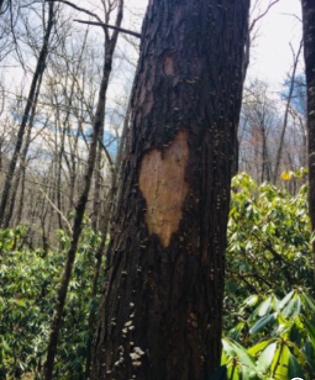
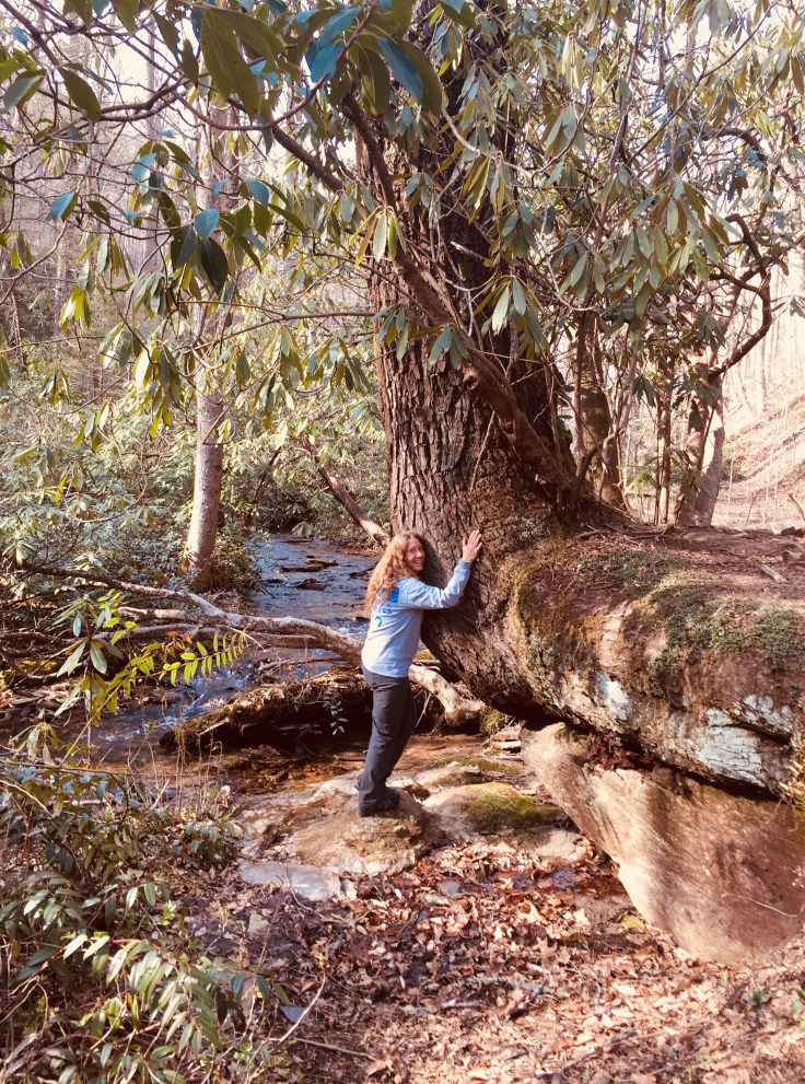
I found the coolest tree on this trail! I love trees. They can grow in the strangest ways. This one is growing over a large rock.
Some more creek crossings and we see a tall but small waterfall to the left. This can’t be Twin Falls there is only one.
We continue down a little farther and there is Twin Falls.
It’s not enough to see a waterfalls we like to get as close as possible and possibly climb on them too! The first Twin is beautiful and the book said it’s 100 ft tall.

We are getting pretty tired by now, even Lisa! But there is something about a waterfall to get your second wind. I’m leading at this point and start scrambling up the rocks to get to the falls and ask lisa how far she wants to go? Dumb question, she’d go up and over if she could!
She stays below to get my pic and I go as far as I can without getting soaked!

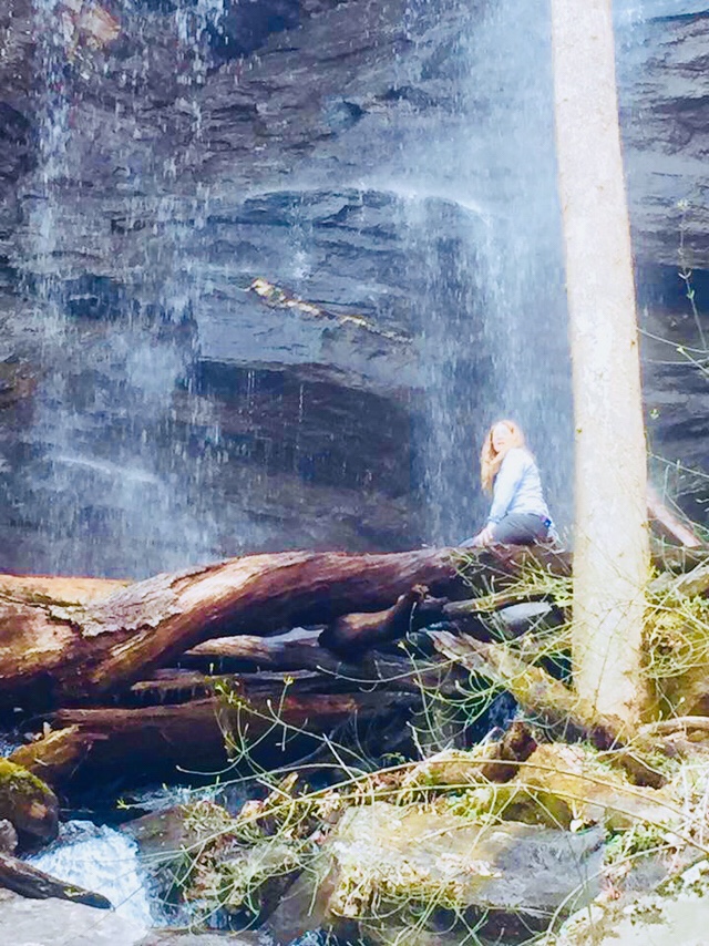
Why I sat on that log I’ll never know because it was soaking wet. I ended up with a wet butt and it was only about 45 degrees outside!

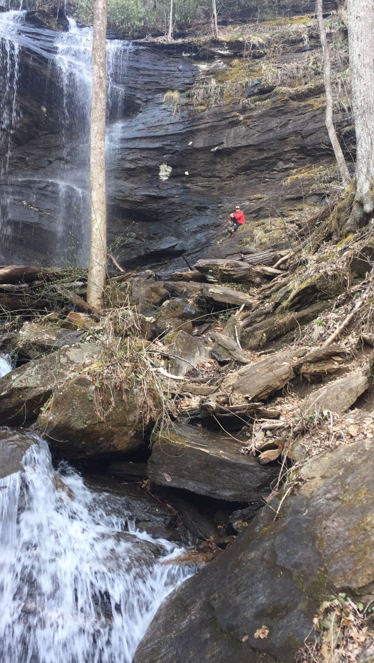
Next it’s her turn to go up. She tried so hard to get near the top to the point I couldn’t even see her but she said it was to slick and nothing to grab onto to pull herself up. (Adventure junkee!)
We have to cross to get to the other twin. At this point it’s really getting late so we snap a couple pics and don’t attempt to climb.
We stop to take a pic of us with 7 fingers for 7 waterfalls.
 It’s 5:48 and 3.5 is miles to the car. She takes off and I follow like the chubby little sister trying to keep up with big sis! This isn’t a steep trail but it must have 8 creek crossings and we made it back to the car at 6:30! I swear we were getting it. That’s like a 20 minute mile and her on 2 hours sleep!
Thank god for daylight savings time! We still had plenty of daylight.

That was a fun day and I’m so exhausted! Her Fitbit says 14.5 miles.
On the way back all I can think about is Bojangles! I’m starving. Got us some Togo and I woofed it down. Even the biscuit that Lisa said is a no no! 🤣

Leave a comment