
Sherri and I
2/9/18
We start at 7:15 for the 3 hour drive. We decide to take highway 11 instead of I-85. We manage to get behind every slow driving grandma, concrete truck or what ever. We make a couple of stops our final one at McDonalds in Brevard for breakfast and a pitstop.
Sherri has been wanting to try Panthertown Valley and I found this 8.8 mile hike with 5 waterfalls. We had written instructions that detailed every step of the way. Should be easy right? We spend a lot of time re-reading and re-reading and re-tracing our steps! If I could remember what I read it would be better but … nope.
This GPS takes us up 281 around Lake Toxaway. We literally follow the lake on a curvy road for 3 or so miles. It’s beautiful but then we get behind a concrete truck and are driving at 20 mph forever. We finally make it to the turn into the trailhead and park.
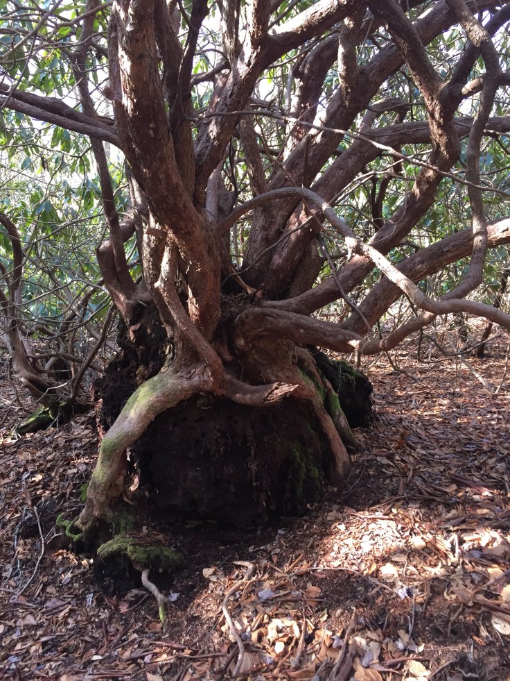
We look at the step by step directions and its 2 pages long so i keep it in my pocket for easy access. We head up the trail, cross a footbridge then begin a series of switchbacks. Its not hilly because its a “valley”. We go over another foot bridge and come to a sign for Schoolhouse Falls trail. We follow that trail up to our first waterfall. It’s really beautiful. The water is crystal clear with a golden tint to it. They say the water looks like iced tea because of the leaves and pine needles from the trees. Its so pretty.
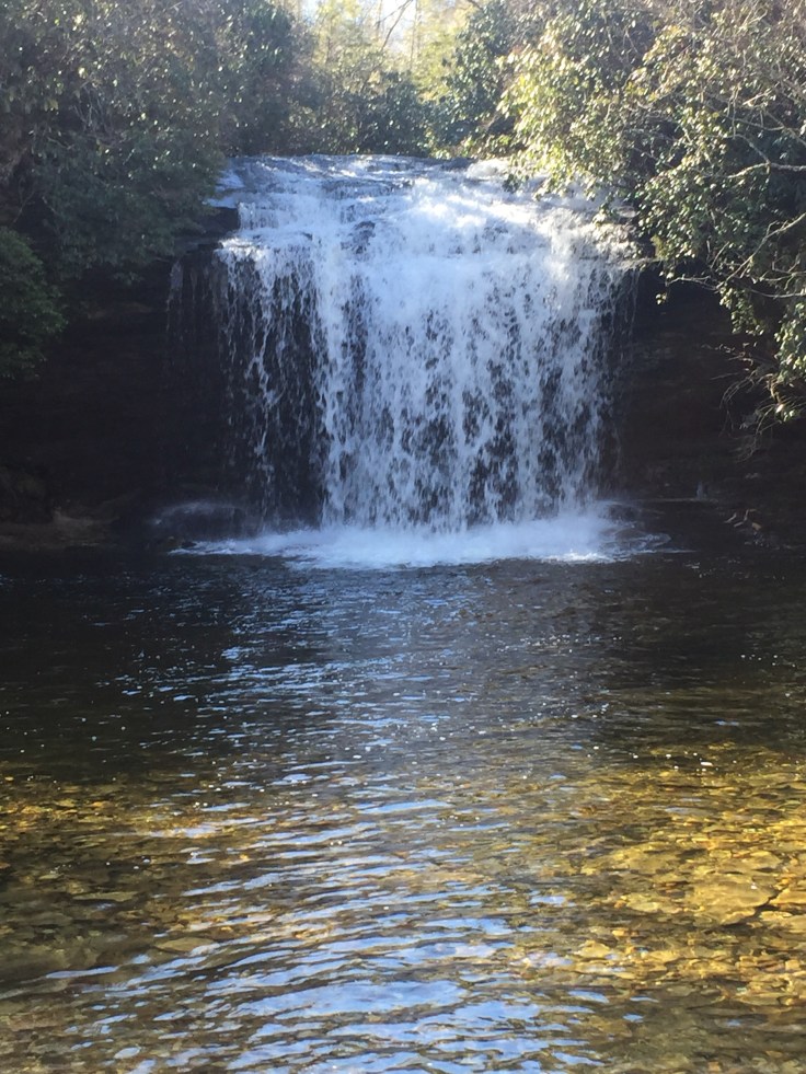

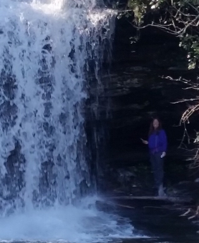
This is a great falls. I notice that i can go behind this falls so i decide to go behind it. Sherri says its very icy there but i decide to scramble up this side trail over and under rhododendrens. I get to the falls and am so excited i forgot that the rocks were frozen and land right on my butt. I didn’t fall in the water just on the rocks. Its really beautiful back here but since I fell I don’t want to attempt to crawl behind so i just take some pics and video from beside the falls. Nothing hurt but my ego!

Then I go back down the trail to where Sherri is. We head back up Schoolhouse Falls trail and turn left back on the Panthertown trail. We walk left and the trail is muddy and in some places appears to be a creek. We think we are going in the wrong direction so we turn around go back the way we came to the Schoolhouse falls trail.
 We cross back over the footbridge and do not see a trail to the left. We decide we were on the right trail and head back up the trail we just came down. It’s a fun trail. We jump from side to side to avoid mud and water. Jumping across rocks. I’m wearing my new Solomans that I am buying from Lisa. I am wondering if they are waterproof but hoping I don’t find out that they aren’t so early in the hike!


We cross another footbridge over the creek and keep going. We come to an area called the sandbar. It’s really cool but seams so out of place. It is a big sandbar along side the creek with a sliding rock waterfall at one end with a swimming hole. Oh I just wish it was summer but would hate to see this place full of people!
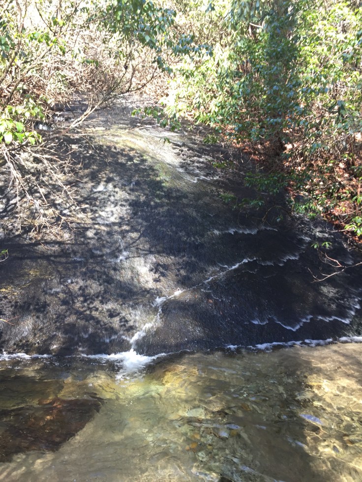
We get back on the trail and continue through a white pine forest. There is what they called a wet weather waterfall. Off to the right of the trail there is a huge smooth rock with water coming down it into the creeks. It was really amazing. I assume that when there isn’t wet weather its dry?
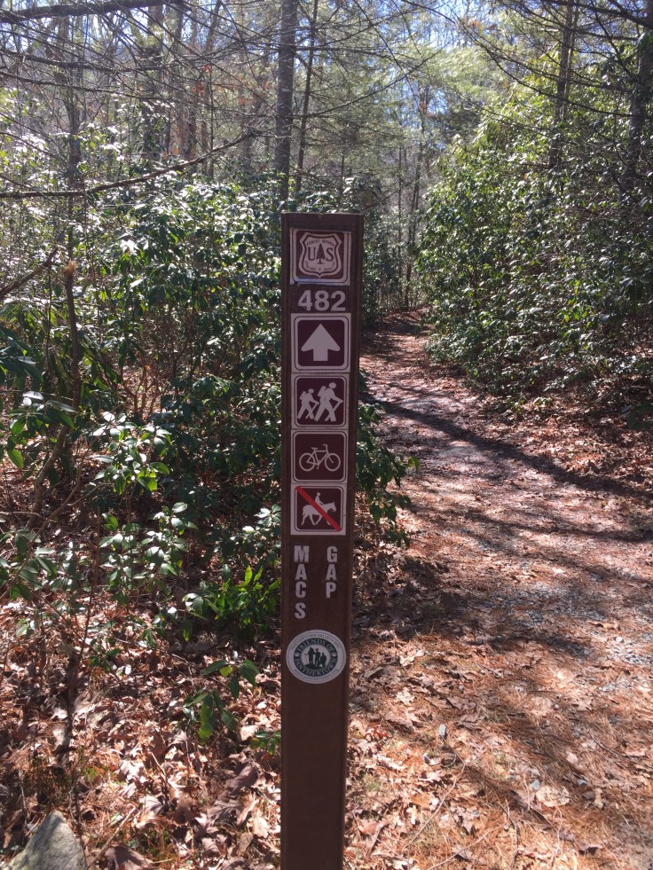
Right from there the trail goes up its first steep climb. There are trails everywhere here. Some are marked some are not. The directions say a trail to the left. There is an unmarked trail to the left or a steep climb straight in front of us. We decide to do the steep climb and when we get to the top we see a sign for Mac Gap Trail, just what we were looking for.
We take the left and head down through the coolest Pine forest. The temperature drops 10 degrees in there. Its really really awesome. Luckily the trail is marked though here or who knows which way we would go.

Next we go across another wooden bridge and come to Granny Burrell Falls Trail. We follow it up and around the creek and can hear a water falls up ahead. The trail is very muddy and wet through here and is thick with Rhododendrons. We try side paths but we are not able to get a good view of this falls. I try to climb out to get a look but the rocks are icy and we can’t climb out to see this falls. Just a couple of side views. We keep going up the trail which goes beside the falls and up to the top but without any good views.


The next trail is the Great Walls Trail. At this intersection the directions say go right and rock hop or wade through the creek. Well there are not any rocks to hop on and Sherri says she’s gonna wade through and takes her shoes and socks off. Immediately she says her feet are burning like standing on ice. I tell her to stand on her shoes for a minute while I trample through the woods looking for rocks or trees to cross on. We can’t find any and decide not to cross. This means we miss Frolictown waterfall and and Wilderness Falls which are down this trail. She puts her shoes back on and we get back on Great Wall Trail. We get on this and the first thing we come to is a camping shelter. We sit down here and have lunch.

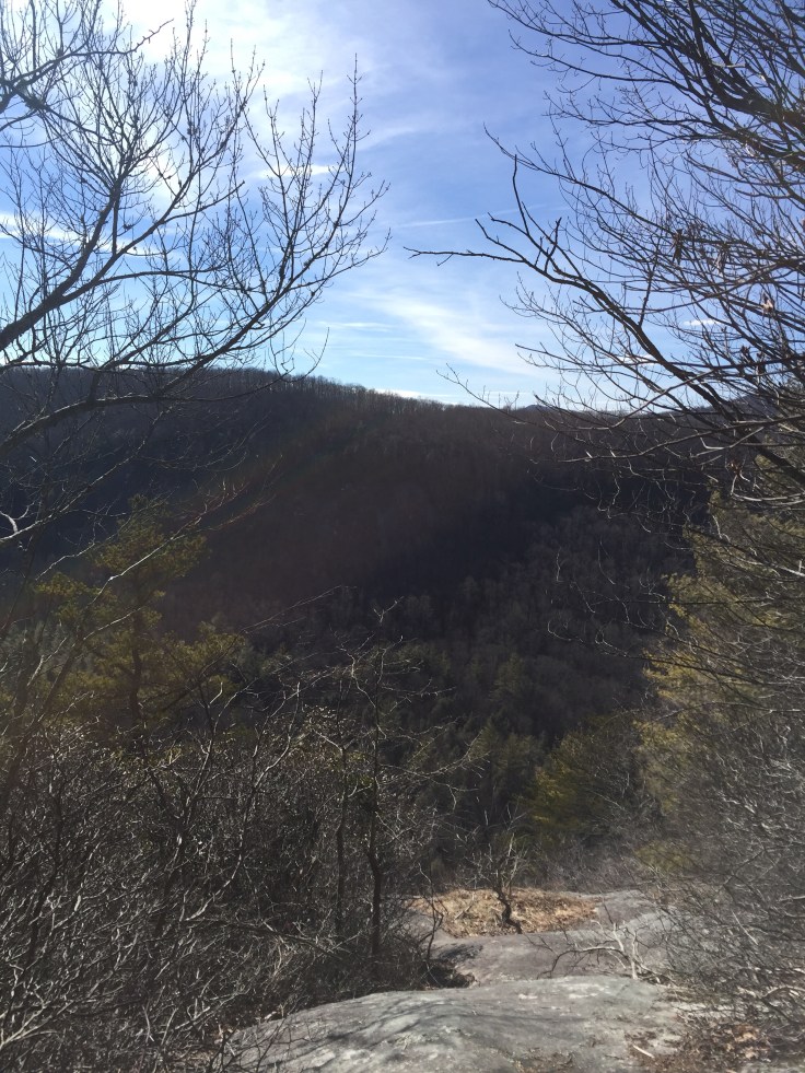
The Great Wall trail goes along Big Green Mountain. This is a huge Stone Mountain called a monolith. It’s really cool and goes on for a long time. This trail goes around Big Green Mountain. Eventually we are going to end up at the top of this!

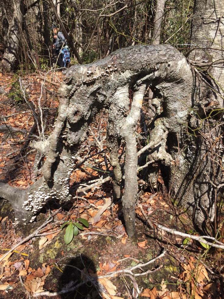
As we are walking down this trail she notices some deer and raccoon prints in the mud.


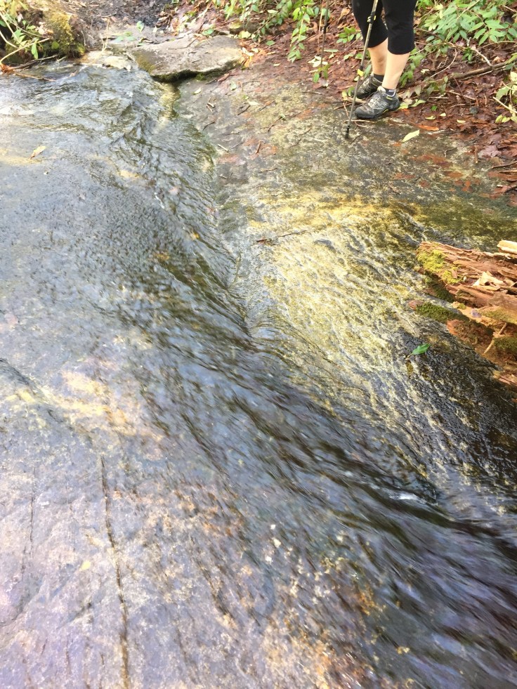
The trail starts to go up. We are climbing up the backside of the mountain and it keeps going up. There are stairs, rock Stairs and climbs. We were talking about this trail being so easy and now it gets hard. This staircase actually crosses the creek and I misstep and in my foot goes. I pull my self out and say “waterproof!” Been wondering all day and now I know these Solomon’s are waterproof!
At the next intersection is go left toward the car or right to the top of Big Green Mountain. It’s now 2:40. We have to go to the top. We hike up to what we read would be a great view but it wasn’t so great. If it was summer we wouldn’t see much. I try to climb down to the edge of the cliff but it scares Sherri. She tells me not to. I say “yes mom” and go back up.
We head back down to Mac Gap trail and I’m reading these directions that say slippery creek crossing, easy creek crossing and “wade Greenland Creek”
I’m like seriously! Wade! We keep walking and get to Slippery creek crossing. This one is cool and we don’t get wet.

Then we come to easy creek crossing. We can jump from rock to rock . We are Still dry.


But now we come to Wade Greenland Creek. I cannot believe this trail has come to a wade. What’s our other option? Go back 6 miles? Once we cross we are only about a mile and a half from the car. Sherri says she’s gonna cross! We walk out in a log and there are a bunch of rocks but all are under water and probably slippery. After a few seconds she does it. Leaps off the log and plows through the water! I’m hooting and hollering! Too funny!
I can hardly believe she did it! My turn. I follow next and drop in the water! It’s cold but I’m so excited about the whole thing it’s not to bad! It was exhilarating!
Now we’re walking with soaking wet feet! This is a new one! We go sloshing up the trail! We keep going to find the next waterfall called Greenland Creek Falls. We are almost to the falls and I re read the directions and tell her this is an optional hike and we have to go back to where we started and cross the creek again! She s like “I’m pissed” I’m still laughing cause crossing that creek was hilarious! We don’t even find that waterfall we turn around and head back up the trail. Turns out we missed a great falls called Greenland Creek Falls. Again I mis-read these directions. It says back at the clearing go up Mac Gap trail. Turns out we didn’t go back across the creek. Thank goodness! I’d hate to think that creek crossing was for nothing. I think for the 3rd time I hand her the directions because I just can’t deal! We head up the trail and it’s muddy. She is leading and slips in the deep mud and lands on her butt! She is laughing so hard she can’t get up and I can’t stop laughing long enough to help her! I’m like omg stay there i need a picture! My sides are starting to hurt from laughing and she is still sitting in the mud! We get ourselves together and I go in front of her to help her up! She’s like those trekking poles didn’t help me at all!
After she gets up we walk up the muddy trail. She is leading and I’m looking at her muddy butt and I say “hey you got a big dollup of mud on your right butt cheek!” We laugh as she wipes off the caked on mud!
The last mile to the parking lot was uneventful. The trail ends on a road. We turn left to go to the parking lot. Where we have to take off our soaking wet shoes and socks and get in the car to head home.
We went about a mile and see a bobcat trying to cross the road. He turns around and runs back down, stops to look at us then disappears into the bushes. Very cool!
Hiking is the best! Each time is different. Today we found out we would walk through icy cold water for the trail! Fun day indeed.

Great time, wet feet, muddy butt and all
LikeLike