
May 25, 18
Lisa and I
Decided to leave at 6:30 am to go to find some waterfalls in Gorges state park.

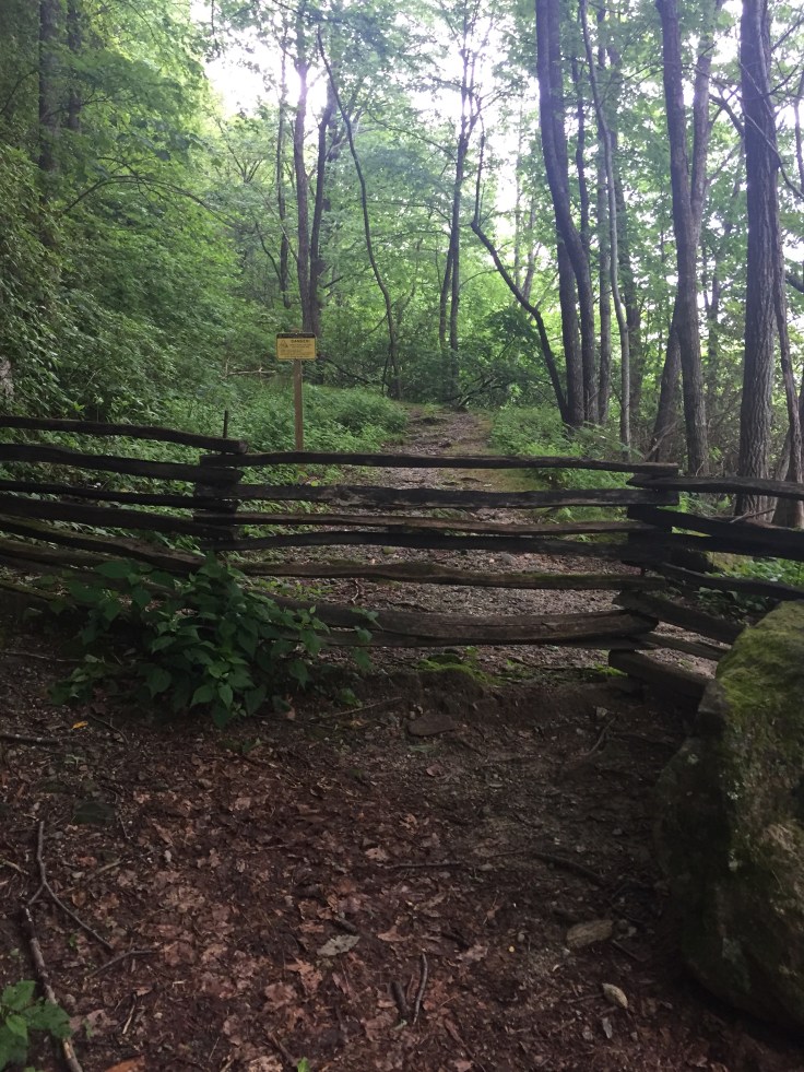
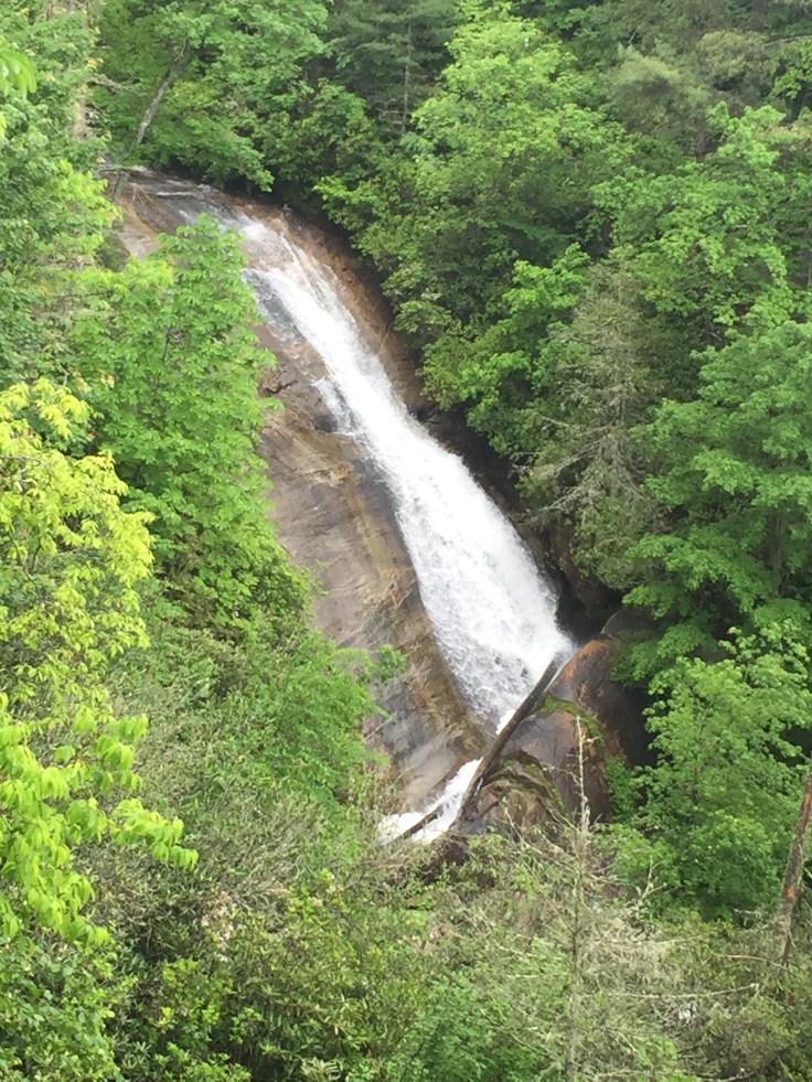
We decided to go to Upper Whitewater Falls first. We figured it was really kicking because of all the rain and it was! First we took a trail that went above the falls that I think we weren’t supposed to go on because it had a fence across it. It was easy to get around though?
We followed this trail and it kept getting smaller. At one point we could see the water but never really saw a good place to get to the falls. Just recently a girl got swept away and went over the falls and died here. Far as we can tell this is the only place where people can reach the water. They must have went here and climbed down a bit. Very sad.

We turned around and went down to the falls viewing area. It was a nice bunch of steps to a viewing area.

The view is ok. I really like to see a Falls a little closer but this is as close as we can get.

We took the trail down to where it meets the Foothills Trail. The Foothills trail goes on down to and crosses the river on this bridge.


To get on the bridge there is a rusty cable to help get up the rock. Otherwise you can climb a larger rock and jump about a foot to the bridge.
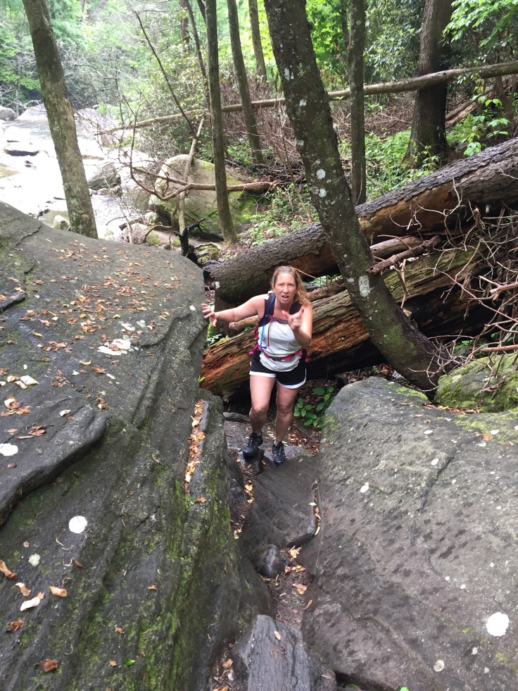
Lisa, of course, jumped. This is her making fun of me as I walked between them after I slid down the rock. 🙄
It was pretty cool to me that this was the foothills trail. When we did the Make A Wish Trailblaze Challenge started just .8 of a mile from here. Went 28.3 miles to October State Park. This direction the trail goes on through Gorges State Park and all the way to table rock NC. Sherri took off a week In September for us to back pack all 79 miles!
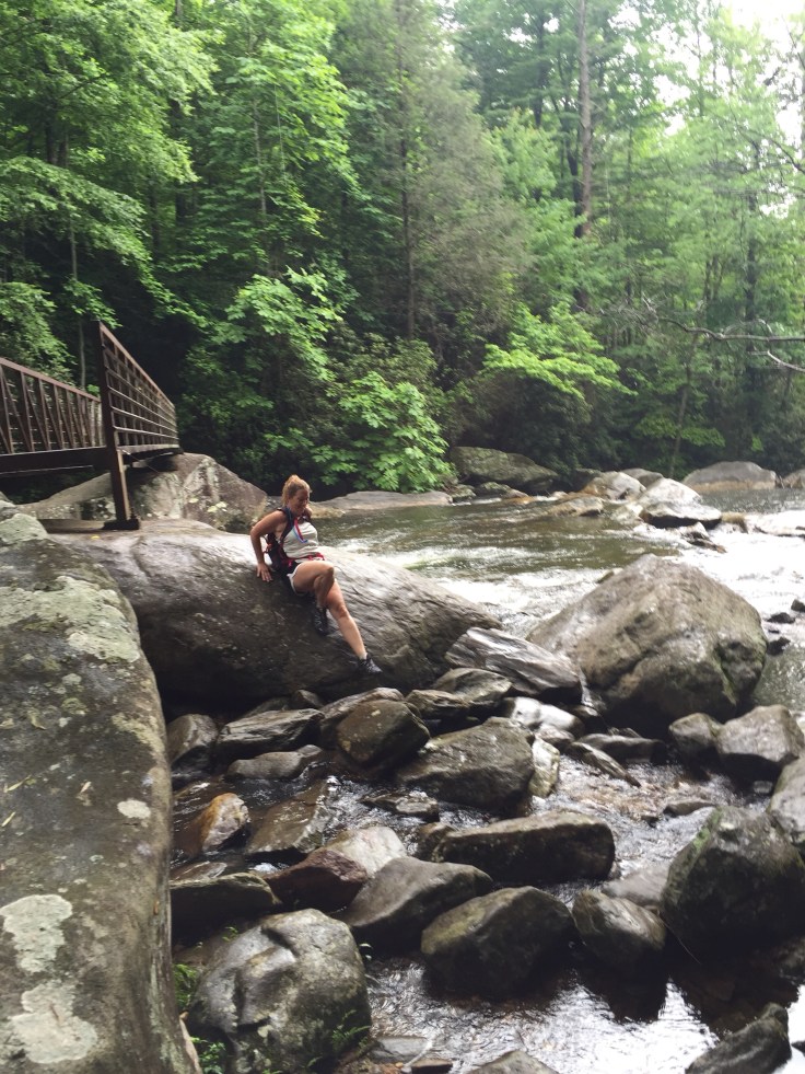
We played on the rocks a bit, well Lisa the climbing monkey did! She climbed up this side and slid down the other. 
We went back up to the parking lot. I do mean up. I can’t decide which way to hike the foothills trail is best, east to west or west to east!
We got in the car and headed to Gorges State Park. We stopped at the visitors center and got a map because there wasn’t any internet. We are trying to find 4 waterfalls that are on a “faint” trail. The lady in the visitors center tells us to go to the campground then all the trails spread out from there. We get in the car drive down to the trail head and head to the campground. It’s an easy trail in the opposite direction of Rainbow Falls. We pass a small pond and get to a primitive campsite with 8 campsites. These are real nice and have 1 Privy in the middle.
There weren’t any campers now. We continued to follow the trail past the campground looking for a faint trail to the right. We walked till we came to a dirt road and then a paved one. We never saw a faint trail so we walked back to the campsite. We walked all over the campsites looking for the trail. The map shows the trail across from the Privy. It was not! We walked back up looking for this trail. We are getting angry. Mainly because their park map did not even show this road! We finally gave up and decided to go see Bearwallow Falls. The trail head is back at the visitors center. The map shows it closer if we go to the parking area so we do. We pull up and it’s raining. We can see a trail behind the bathrooms. We decide to take that trail to the falls. There are a couple of people on motor cycles there under the picnic shelter getting out of the rain. They must of thought we were nuts going up the trail in it!

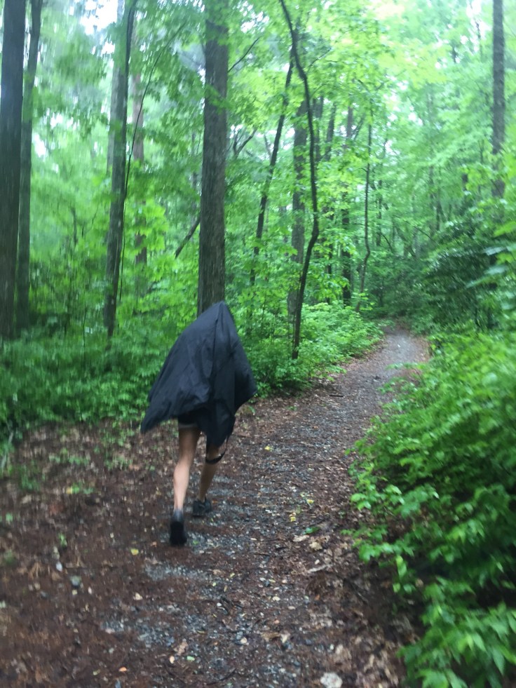
It’s rainy so I grab my poncho and she grabs a blanket? Idk what it is! We head up this trail in the rain.
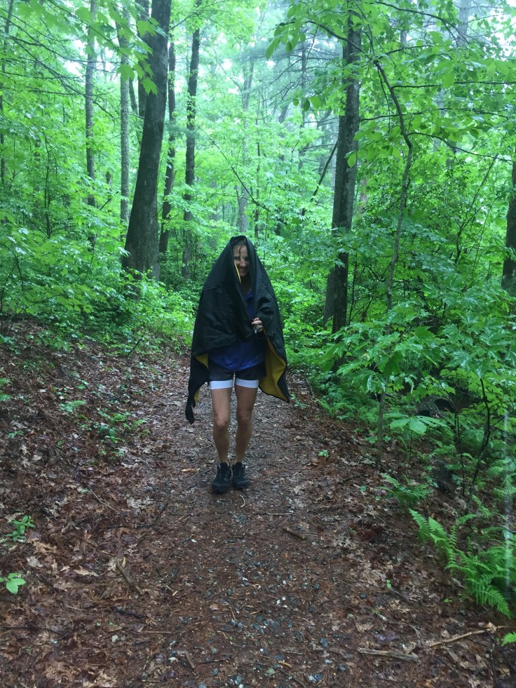

We follow the trail till we see a sign that says visitors center and observation deck. We head that way and come to another parking area. We figure we went the wrong way and go back and find the observation deck. Idk what it observed but all I see are trees. It’s right next to the power lines. We check the map again and cannot figure where to go. We follow the trail till it comes to the visitors center. This falls is 1.5 miles from here. I call the center and she says go to the bearwallow parking area and it’s 1/2 mile from there. So, back we go. We complained about the state park map the whole way! The trails have Blazes but the park map has zero blazes and the only trail they name is rainbow falls! We get to the parking area and decide to use the restroom. From the restroom we can see the sign for the falls across the road. The map does NOT show crossing the road!
We walk down the trail which is only a half mile to the observation deck. Part way down there is a bench on the trail. Lisa says “you know what that means don’t you?” No i don’t 😜. She says ” it’s all downhill! That’s a break bench!” 😂😂 We arrive to view the falls. It’s nothing but thick forest along the falls and river and we can’t see anyway to get any closer.
This is all we can see. We can’t see the river below or anything! So up we go to head back to the car. We have walked 11 miles so far and most of it was in circles. Circles in the rain! We decide that’s ok because we like to hike. Hiking in the rain isn’t so bad when it’s not cold. The views are blocked but it’s fun anyway!
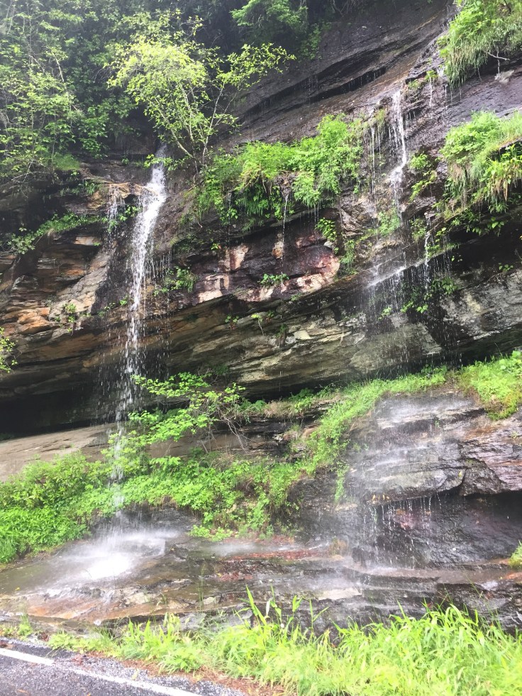
Finally back at the car it’s almost 4pm. There is one more waterfall she wants to find. It’s Raven Rock Falls. It’s not in her waterfall book. She found it on a facebook group called waterfall junkies. It is on private property. It’s on 281 near Brevard. The only description is Powerpole 61. On the way there is a small waterfall on the side of the road.
We find it and park. She has been here before when it was frozen. There is no sign of a trailhead on the road you just have to look over the side past the weeds and there it is. It’s a short trail that hits two waterfalls. It’s a kinda steep rugged trail. Clearly doable. It passes big rock walls.

Then we come to the first waterfall that has a wooden bridge behind it. It’s really cool. I read it was called Bridge of Death. If it was it shouldn’t be. Someone has rebuilt it!


Lisa came here when it was frozen in January. It looked like this.

From here the trail is a little harder but only because of the wet. We can barely see a big falls ahead. We walked down a little more and come to a beauty called Raven Rock falls. It is super cold down here. I’m not sure why.

Of course the climbing monkey wants to get closer so she starts climbing up the side of the waterfall.
It Does make for some cool pics though! She said the spray from the falls was soaking her.

So she comes down and says it’s my turn. I’m cold and it looks slick. Stay on the moss she said. I give it a try it don’t get very far. First I do not like to touch slimy stuff and 2nd it’s slippery!
She thinks it’s funny to take videos of my struggles. I can’t get that video to load but you get the picture.
This is a pic of this waterfall frozen that she took.

So we take some more pics from the base and head back up to the car.

We are heading home and she wants to eat. We look like crap but did being extra shoes and clothes. I found a restaurant in downtown Brevard. It was called The Square Root. We sat outside. The food was very good. They have won Best of WNC 5 out of the past 7 years.
On the way home we stopped off at Dairy Queen for a Blizzard. I was so tired I dozed off in the car a couple times. We got home about 7:30.
I immediately went to bed. I was asleep by 8 and didn’t wake up till 8:30! 12 1/2 hours!
My kids think I’m so tired cause I work hard to keep up with Lisa. Hmmm. Sometimes maybe, but not today. These trails weren’t difficult we just did 13 miles!
Rain or shine hiking is fun!

Leave a comment