
Sherri, Lisa and I
6/19/20

We got here Thursday and went to find the best place to catch a sunset. Clingmans dome was super cold and socked in. We went down to Morton’s Overlook. By the time the sunset it was packed full of people!

We are staying at the Indian Creek Campground in Cherokee NC. We love this campground. It was completely booked for the weekend.

This is our 3rd attempt to get to Charlie’s Bunion. 1st time it poured, the 2nd time we came after severe storms and the entire 441 was closed and now it’s cloudy with a chance of rain but we’re here!
We got to the Newfound Gap trailhead around 10. It was pretty busy but not yet overcrowded.We headed straight up the trail.
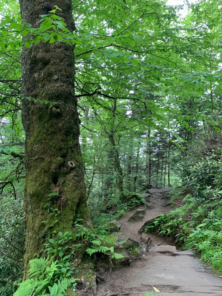
It was over cast most of the day and the trail was pretty dark and damp the whole way. It’s a green mossy, green fern kind of trail which is pretty cool.
The trail is the Appalachian Trail. It goes up for most of the 4 miles.
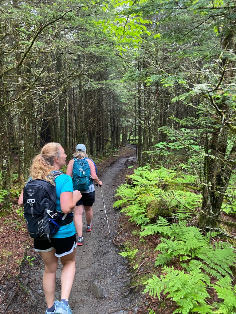
When you start there are lots of people. The further you go the less people you see.
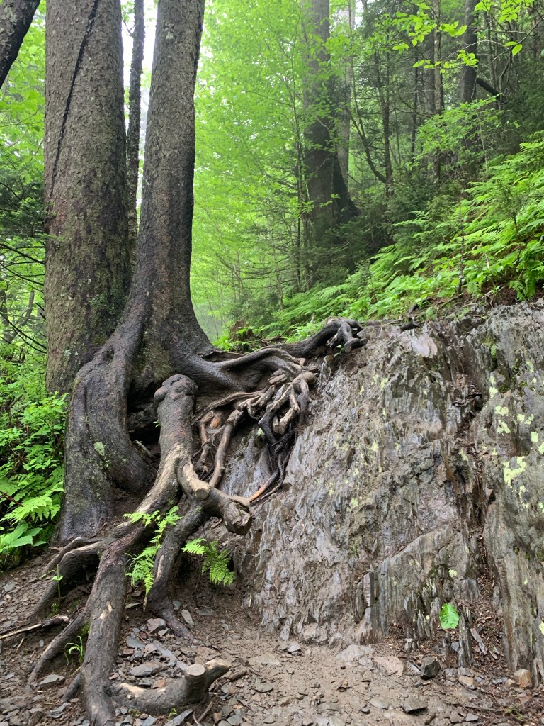
If you read about the trail it will say that the views are great. We did not get it that day. We never got to see any views going up the AT. We took a detour to go to the Ice water Spring Shelter on the AT. It was one of the nicer ones I’ve seen. It had a fire place built in.

There would probably be good views from here but not today. Just past the shelter is a water supply. A pipe coming out of the ground.
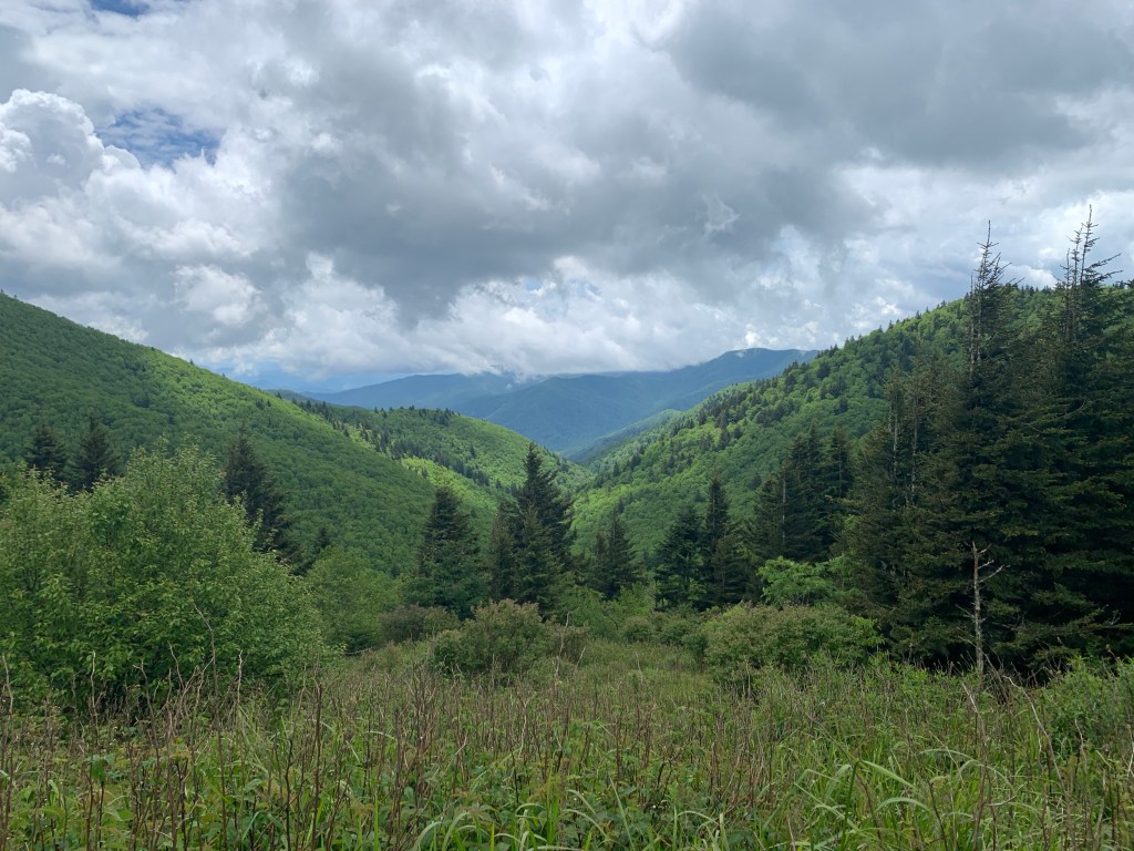
As we got near the turn to Charlie’s Bunion we started to see some views.


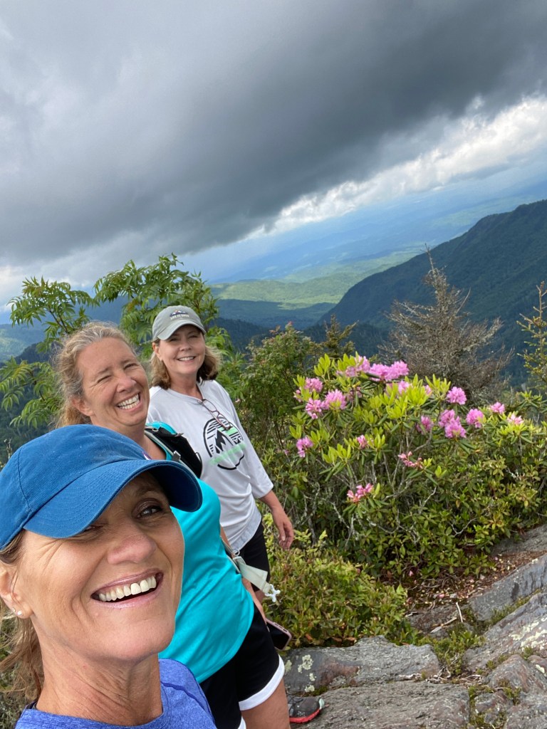
There is a Spur Trail to Charlie’s Bunion. Lisa climbed up on this large rock and we can hear people above us.
For some reason AllTrails says this is Mesa Knob. We continued around the trail thinking we would go up where the people were. It was a thin trail with long drops on one side. We never saw how to get up top. The trail interesected with the AT again and we went left following AllTrails toward Charlie’s Bunion. We stopped to take a nice view pic.

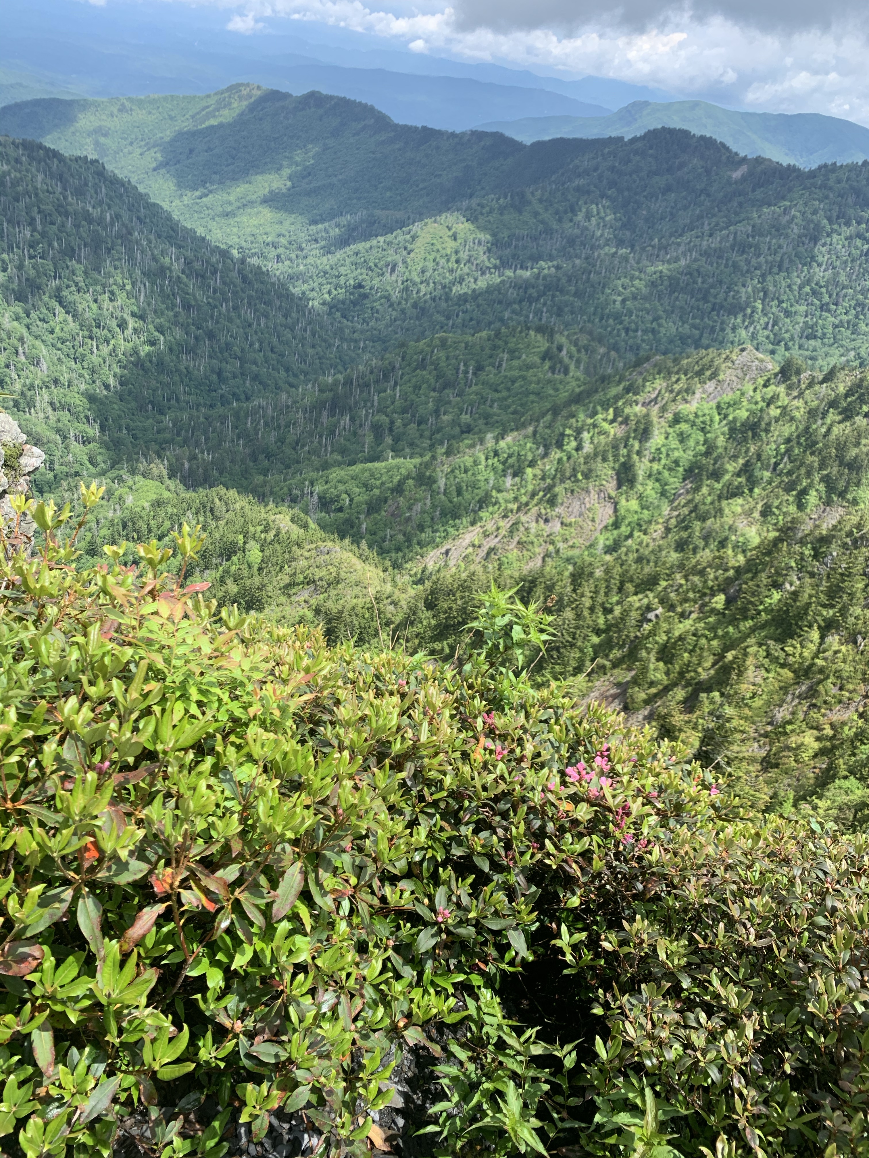
We continued down the AT and I asked Lisa to check her map. We missed another spur trail we turned around and guess where that side trail was? Right where we took that view pic. It was a steep climb to some jagged rocks with lots of views Alltrails map says its Charlie’s Bunion. We stopped to have lunch.
We can see those people who were above us at the last Rock. The weather gave us a nice break and we got some nice views.


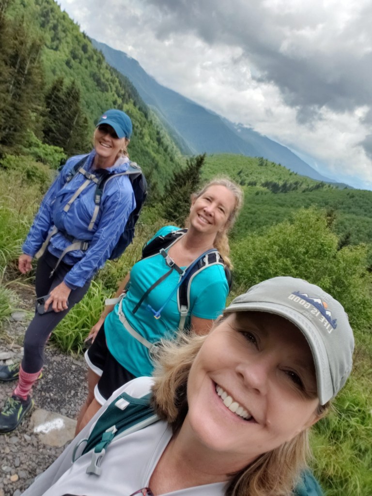
We started back down the spur trail and got back on the AT. We bypassed the spur trail back to Charlie’s Bunion or Masa Knob and continued on the AT. Then the rain came. It was thundering, then raining but the tall trees kept us dry for the most part. Then it rained a little harder and we out gear on. I didn’t bring any rain gear but Lisa gave me her rain jacket and a cover for my back pack.
After a bit the rain quit. When we got to the spur trail for Jump off rock we skipped it because we were deep in low clouds.
We finished at 10.5 miles. I’m still not sure which was Charlie’s Bunion but we definatly went! I kinda regret not getting to see jump off rock. The Smokey’s rain on us more often than not. Sometimes you’ll have that.
I have tried to google and find out which is the real Charlie’s Bunion. I didn’t find anything. Today Lisa texted me the pic below!
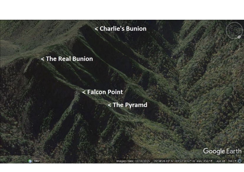
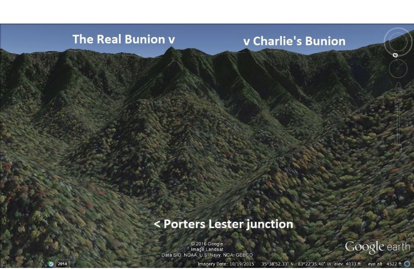
So where everyone goes is Charlie’s Bunion but where we went was the real Charlie’s Bunion. Case solved!

That is a terrific pic!
LikeLiked by 1 person