
5/16/21
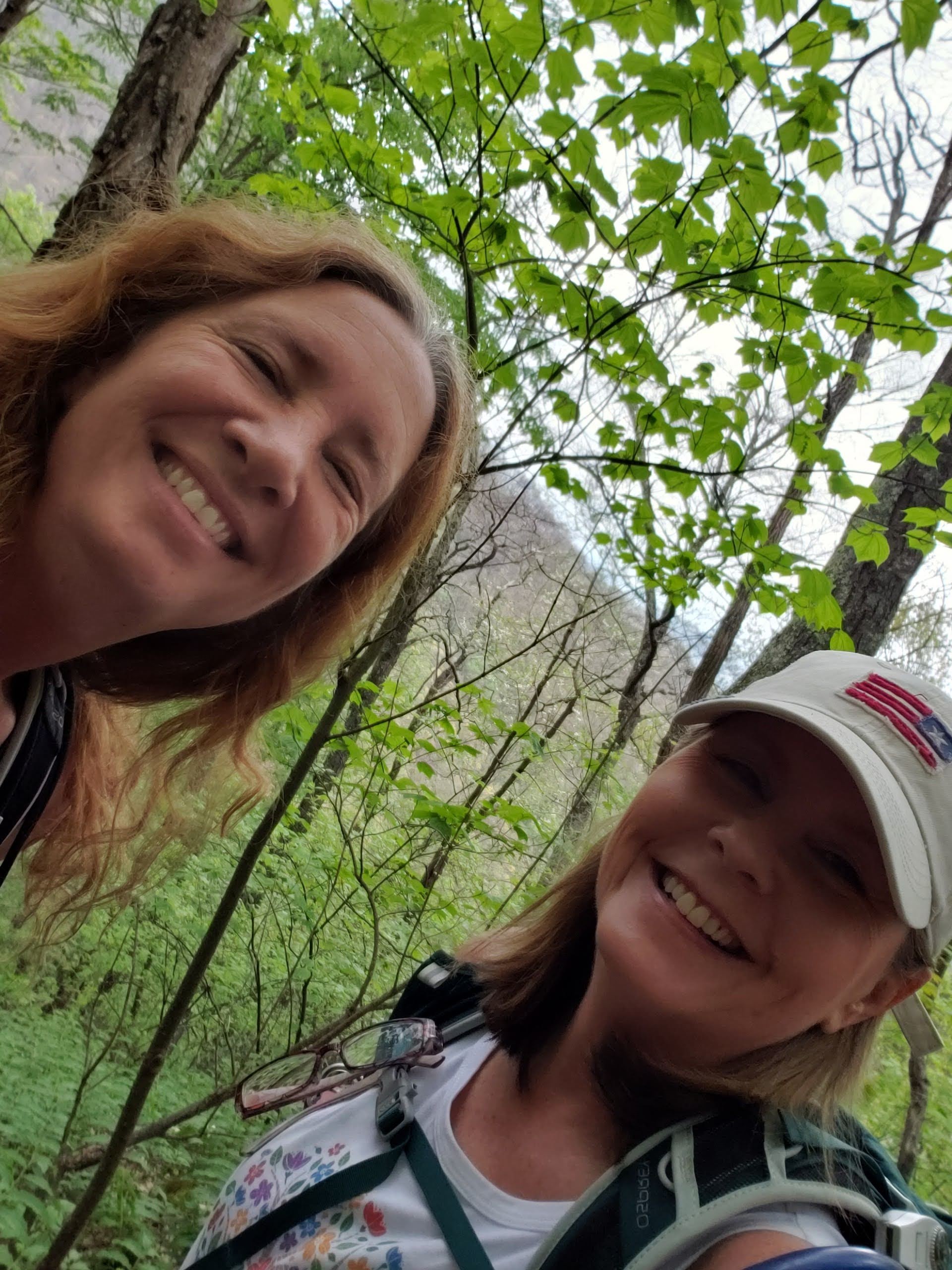
Sherri and I
The hike up Cold Mountain leaves from Daniel Boone Boy Scout camp near Canton NC. A very cool boyscout camp. First thing I saw was a beaver or something swimming in the lake. Then an amusing 12 1/2 mile and hour speed limit sign. We parked on the road along the river near the tents for campers. The trailhead was across the street. This trail immediately started going up.
This trail is nearly 11 miles out and back and over 3000 feet of elevation change. I did not read about it first but since I’m going to the Tetons and Sherri is going to Colorado it seamed like a good idea to her! 😁
There were tons of wildflowers along the way. After two hikes with Holly I felt like a wildflower expert. I was pointing them out and even naming them. I’ve been looking for the Flame azalea and found it along with lots of others.


The trail went up and more up with only a few level areas. We saw backpackers coming down. We heard one of them refer to the trail as chunky. I guess because a lot of it is rocks. Big rocks not like gravel. Seamed like a good description to us.
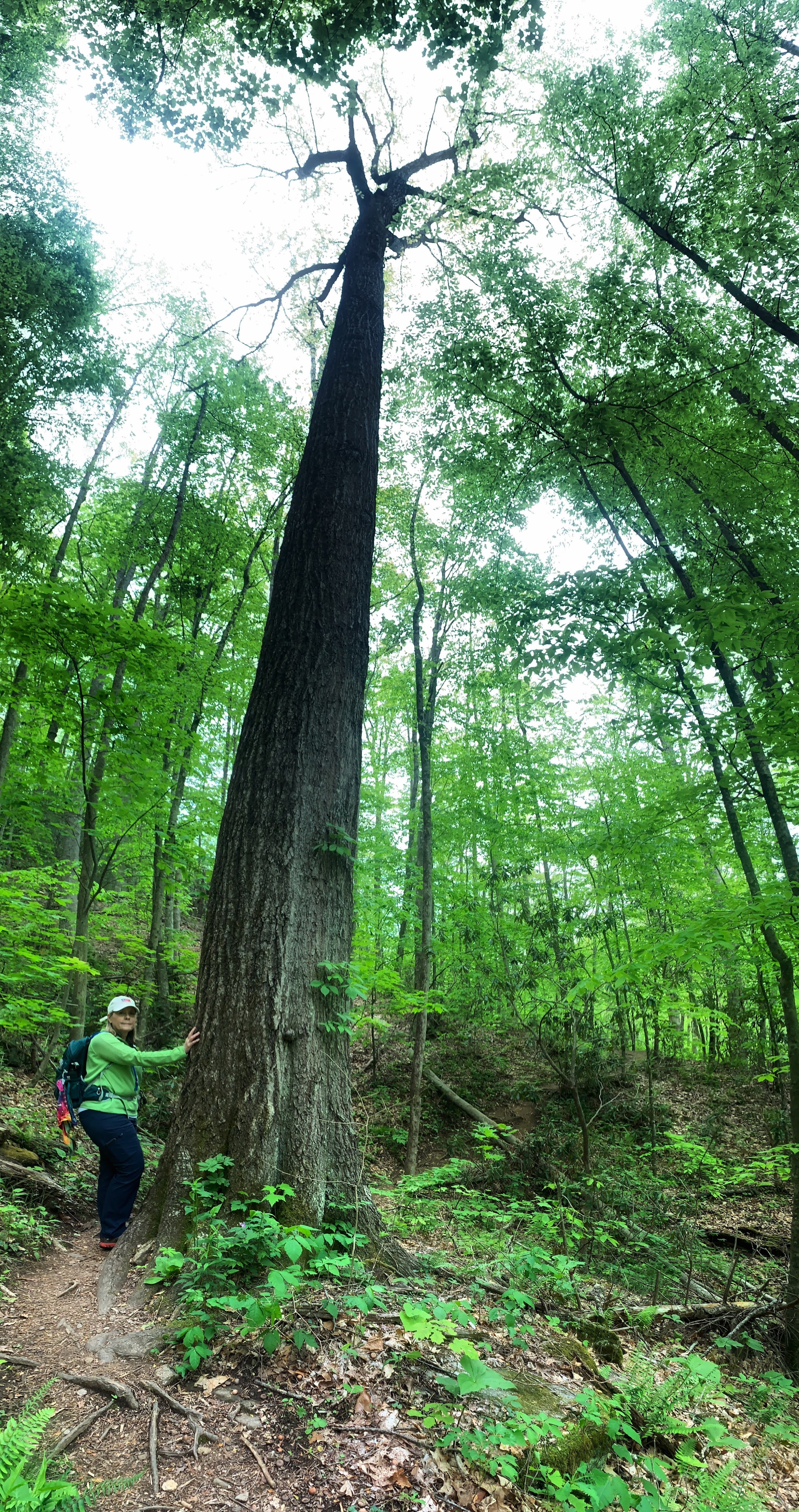
Along the trail there aren’t many views so it’s a good thing it’s wildflower season. The views are mostly obstructed by trees. Very tall trees. In the next pic you can barely see where we are going. To the top.

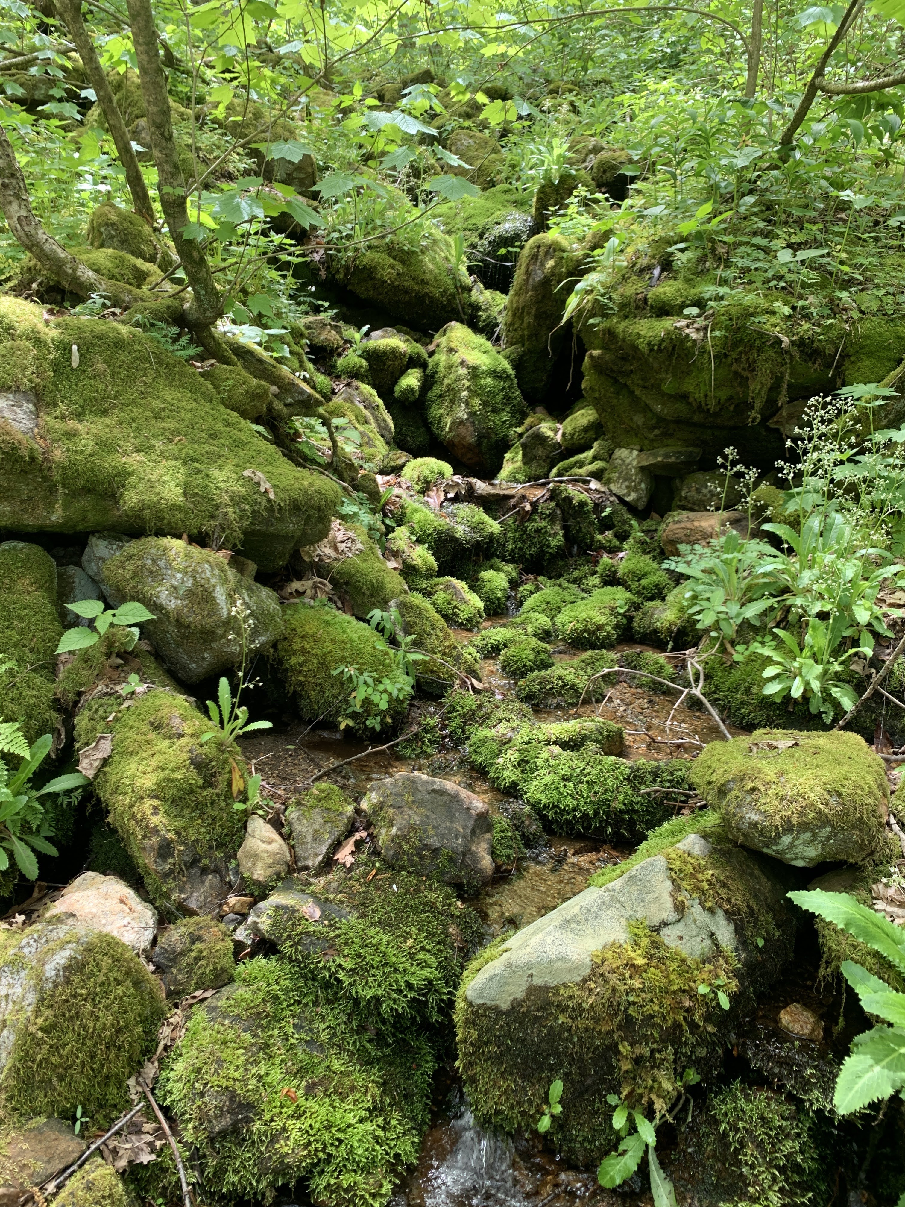
There were a bunch of stream crossings and muddy parts but nothing to get wet shoes. It was very remote and damp. One of my fav pics was the moss covered rocks on the stream.
The whole hike up was super tall trees. The forest was super green and the forest floor was covered in green vegetation. It was really stunning.
I learned a new trick on Tik Tok to use on my iPhone. The picture below shows Sherri next to a tall tree. I took the picture using the pano sideways to get the whole background in the pic. This would have been so cool in the Joyce Kilmer Forest of old growth trees. BTW I love Tik Tok!
We kept trudging along. We did not see to any more people. When we finally got to the intersection of the Art Loeb Trail and the Cold Mountain Trail we sat down took a break and mostly talked about turning around. According to the sign we had gone 3.8 miles. My Gaia said we were closer to 5! Early on I was ok with turning around but now I’ve come to far. Sherri was leaning toward turning around. I encouraged her to go a little further. Then the trail got steeper! Damn it! We kept climbing little by little. I turned some music on. That always helps me. I was dancing and climbing. Then I thought maybe I shouldn’t exert so much energy dancing. She pushed on. At about 3/4 of a mile from the top she stopped. She said her legs were shaking and we had a long hike down. Some days you just know your limits. Some days I feel super strong. We could hear some loud birds above us and see the top of Cold Mountain. It looked far.
She made me go on. I do not like hiking by myself. We haven’t seen anyone in a long time and it was very remote. I decided to go. I took her bear spray and some water and of course left my pack and did the last 3/4 ish mile to the top. I was basically running up the trail breathing so hard. It wasn’t as steep as I read because there was some flat spots. It wound around the mountain then up to the top.
There were about 5 of this big birds that now I know were ravens. They were huge and loud. I startled one and he took off which of course startled me! He came toward me and I was snapping pics as best I could. Only one had a bird in it.
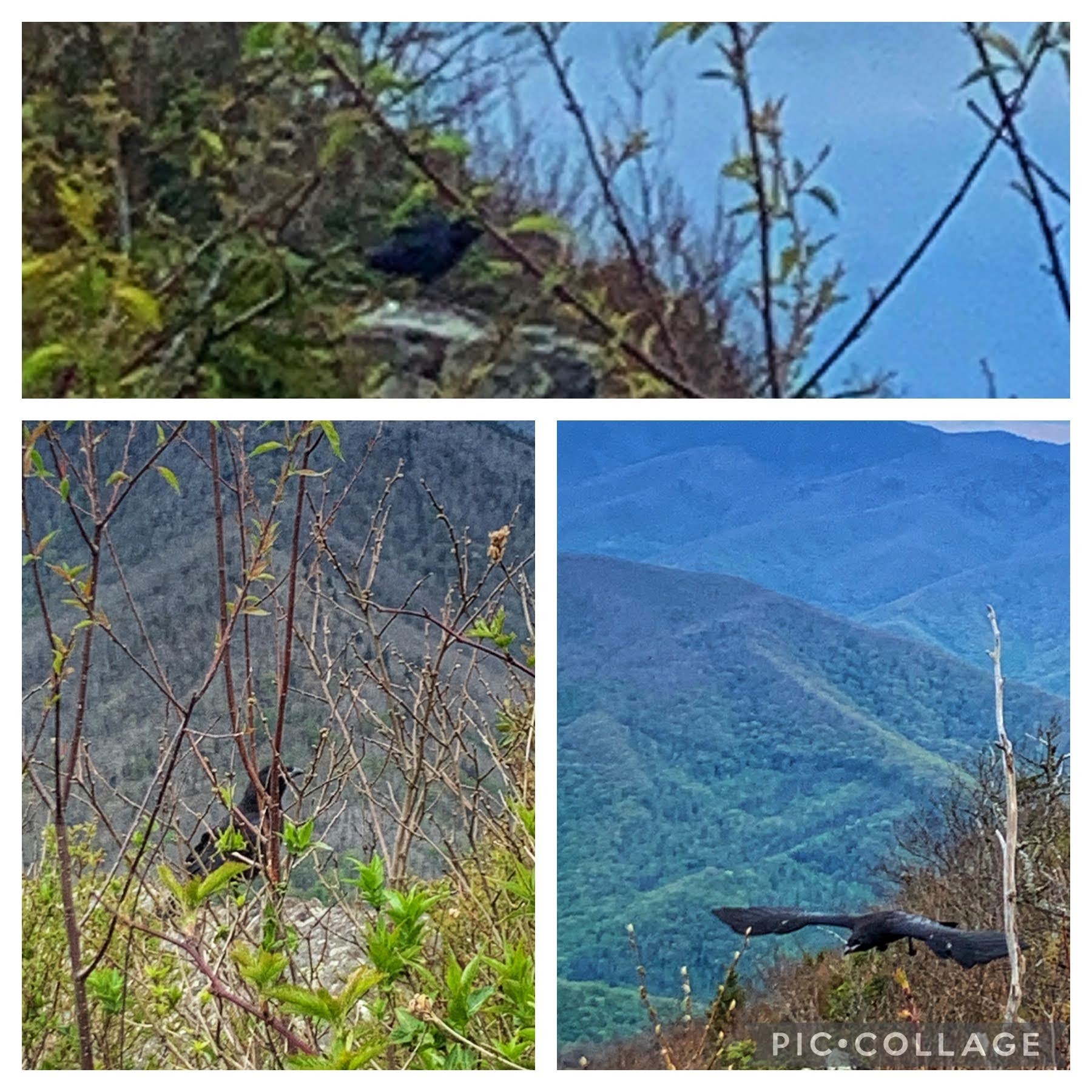
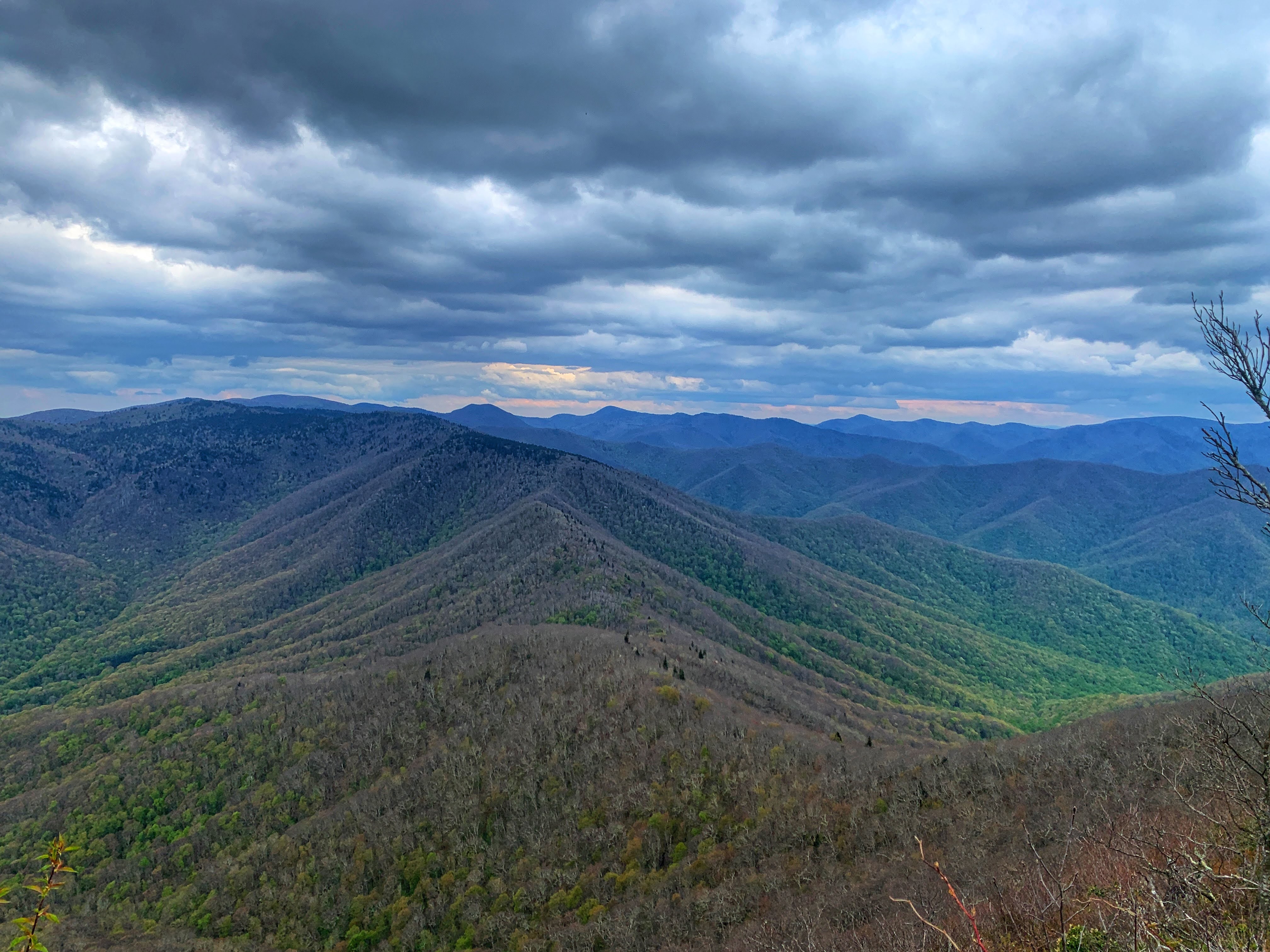
It was pretty cool up there. Like a ridge line. The trail skirted the edge on the right. There were some rock out cropping with great views. Then the trail just ends. I found out later that if you stand tall and look at the end of the trail you can see Mt Pisgah. The pic below looks like a sunset but it was only about 4pm. After I got my views and caught my breath I turned to head back down.

On the way down I passed more people than I’d seen all day. Two different girls trail running. For real? I could barely hike it and they were running! I mean the elevation, rocks and wet areas! If only! Sherri said but your not in your 20’s anymore. That was comforting. 🤷♀️
On the way back down I hear Sherri you talking to someone. They were making plans to hike. Hmmm. As I get closer I said “Holly?” So crazy running into someone you know on a lightly traffic trail like this. Her friend from California was here and they decided to do this hike. She is the one who taught me what flowers were which. Of course she totally enjoyed hunting flowers on her way up!

Sherri and I started the trek down. We were very tired. It felt like it would never end. Gaia wasn’t responding part of the way down so I couldn’t tell where we were. When it finally showed up we were still over a mile from the car. We were so tired!
I read that this trail had an elevation gain of 3225 ft in 5.2 miles. That was some climb! This is the start and finish. It doesn’t take into account for the downs and ups so………


Leave a comment